|
We had a pleasant and un-eventful crossing to Calais, then
motored off to Brussels for our first night. We had a wander
around the neighbourhood, |
|
 |
La Maison du Roi (The "King's House" in French or
"Broodhuis" in Dutch), which now houses the historical City
Museum.
The Dutch name "Broodhuis" (bread house) gives the true origins of this building - in the 13th. century it was a wooden construction, used by the bakers to sell their bread. In 1405, a stone building replaced it and when the bakers turned to selling their products from house to house, during the early 15th. century, the bread hall began to be used for administrative purposes by the Duke of Brabant, giving rise to the French name "Maison du Roi." |
| Here's a detail of the roof of the Maison du Roi.
Imagine how these figures must have looked when the copper-bronze was new. |
 |
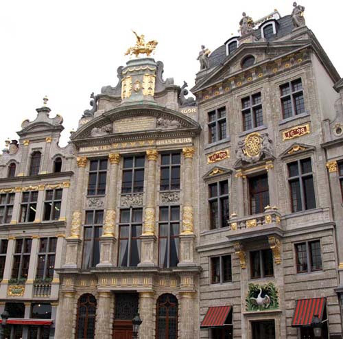 |
This is the South-East corner, in particular, the Maison des
Brasseurs (Brewers' House), which dates from 1698.
The Brewers' Guild financed the re-building, following destruction in the attack by the French in 1695. Details from the architecture follow: |
| This man-on-horse statue on top of the building was added in
1901.
It's a copy of a 18th. century work representing Charles of Lorraine, who was a benefactor of the corporation. The building is currently the national museum of the brewery. |
 |
 |
Attached to the Brewery Museum is the former guild house of the
Butchers Guild - where Karl Marx worked on The Communist
Manifesto during a 3-year sojourn in Brussels.
It is now "La Maison du Cygne," a one-Michelin-star restaurant. I've no idea what the food is like, sorry! |
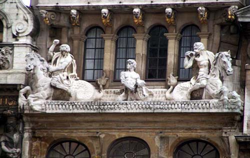
| This is an architectural detail of one of the Grand Place
buildings.
It's stunning now, but in its hey-day, when all the sculptures were fresh and crisp, it must have really been a sight to see. |
 |
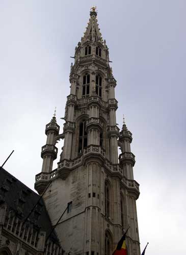 |
The 96 meter (312 feet) high tower above the roof of the Hotel
de Ville (the Town Hall), on the South side of the Grand Place.
Its square tower body narrows to a pinnacled open design. At the very top is a 5 meter (16¼ feet) high gilt metal statue of the archangel Michael (patron saint of Brussels), killing a dragon. |
| A closer look at the buttresses. | 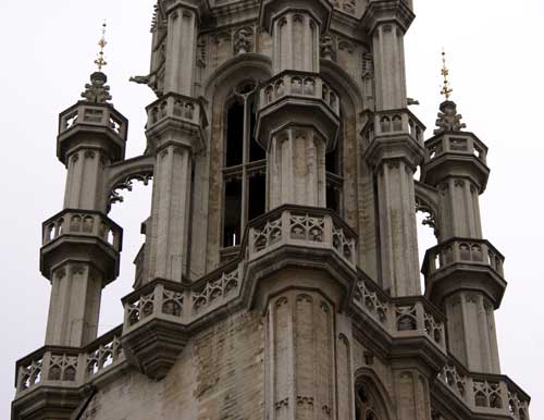 |
 |
The oldest part is its East wing, built from 1402 to 1420. A
second, shorter wing was completed in 1449. The right wing was
built by Guillaume (Willem) de Voghel.
The tower, its front archway and the main building facade are conspicuously off-center relative to one another. It's known as the "crooked spire," but it's not that easy to spot if you don't know about it. |
| The East side of the Grand Place. It's difficult to pick a favourite building, they're all very impressive. |  |
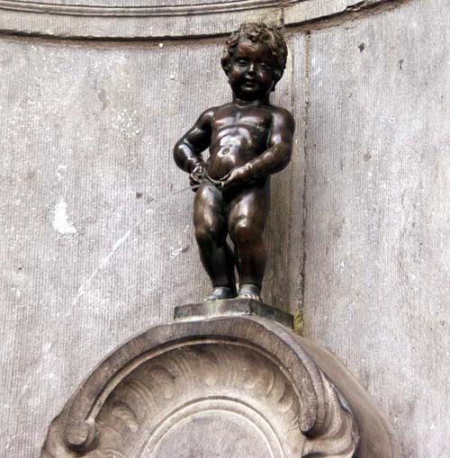 |
This famous statue of a little boy peeing into a fountain has
amused visitors on the corner of Rue de L’Etuve & Stroofstraat
since 1619.
Over time, it has become a tradition for visiting heads of state to donate miniature versions of their national costume for the naked boy. The wardrobe of Mannekin Pis can be seen at the Brussels museum and includes over 760 outfits – even an authentic Elvis jumpsuit. |
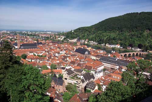
| We then drove to Heidleburgh, which stands on the River Neckar
(which flows into the Rhine at Mannheim) and is known for its
ancient schloss (castle).
This picture shows the Heiliggeistkirche (Holy Spirit Church) just to the right of centre. We stayed in the hotel nearest to the funicular railway, so were able to easily visit the castle in the morning. |
 |
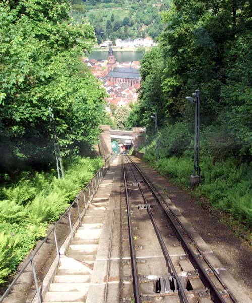 |
This view out of the railcar window, shows the loop of cable to which the cars are attached - one at each end. The cars are very modern and a pleasure to ride on. From our hotel, the castle was downhill. |
| Here's the older part of the funicular railway, which goes up to the top of the Königstuhl. Beautifully kept and lovingly maintained, it's great to see it working. | 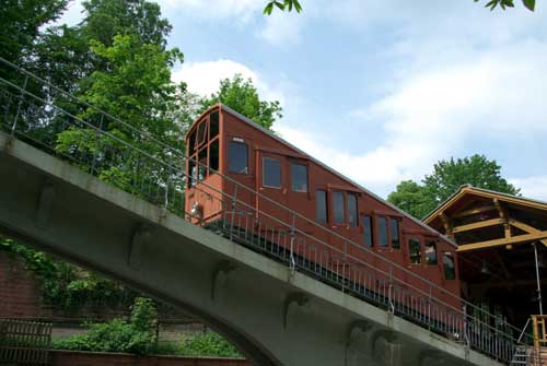 |
 |
The first part of the castle ruins. The castle is a mix of
styles from Gothic to Renaissance. Prince Elector Ruprecht III
built the first building in the inner courtyard as his home.
In the 16th. and 17th. century two palace buildings were added and turned the fortress into a castle. Under Friedrich V (1613–1619), the main building of the West side was erected, the so called "English Building." The castle and its garden were destroyed several times. Lightning struck the Castle in 1764 (during yet another restoration programme) and this finished all attempts to rebuild. Later on, the castle was misused as an easy source of building materials - castle stones are in many houses in Heidelberg. This plundering was stopped, in 1800, by Count Charles de Graimberg, who made every effort to preserve the Castle. |
| This part of the building has suffered from severe slippage! | 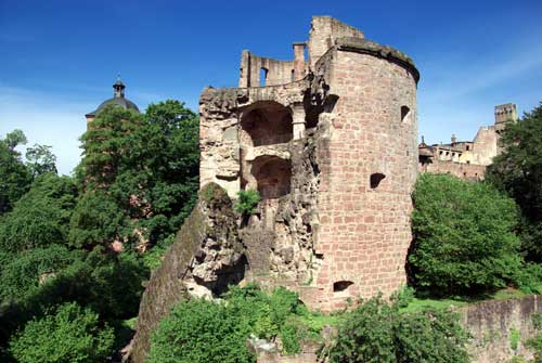 |
 |
This is a detail from the Inner Courtyard building, a very impressive addition to the Castle. |
| The Karl Theodor bridge, over the River Neckar. It's been
rebuilt nine times, the last in 1798.
The twin white towers on the left of the picture are the double-armed gate to the town. They also contained the bridge-keeper's living quarters (refurbished as artistic apartments in 1945) and a dungeon. The bridge only carries foot traffic nowadays. |
 |
 |
Our journey then took us further East and South, through Baden-Baden and on into the Schwarzwald (Black Forest). |
| The weather was dry, but overcast. That didn't detract from the magnificent scenery we were passing through. | 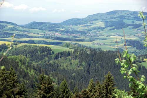 |
 |
Along the way we found a number of houses that we would be pleased to own, including any of these. |
| Little towns and villages, although not that far apart, are often entirely different in both style and character. |  |
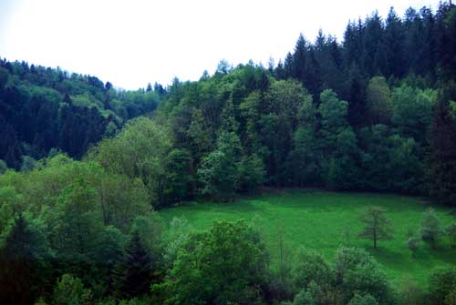 |
We were passing through at a lovely time of the year, with a very large variety of new green growth in the trees and fields. |
| We stayed at Titisee for a few days and used the time to do some
travelling by train. The area has a simple pass scheme for
tourists, which makes public transport free to use within a
surprisingly large radius. These free passes are offered by most
hotels and guest houses and details available at bus and train
stations.
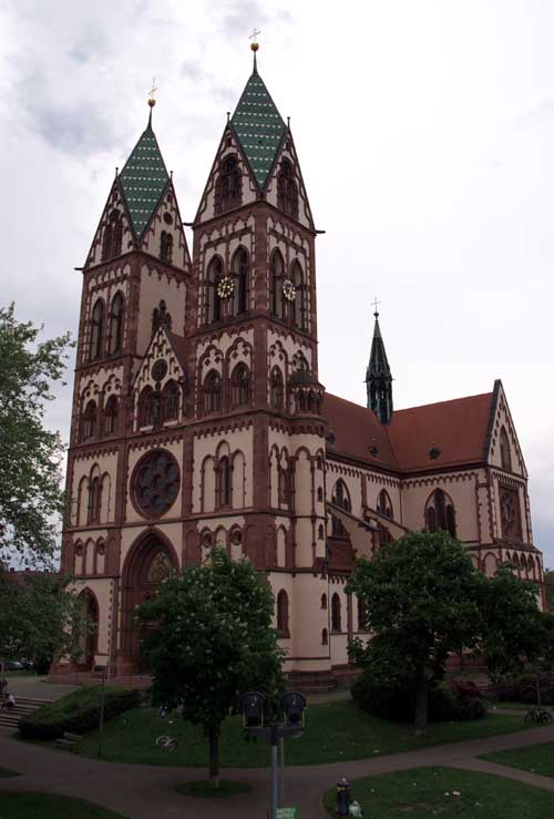
We went to Freiburg to get a different view of the scenery from the train. The train ride was great, Freiburg not so, but we did see this unusual building, the Herz-Jesu-Kirche (Sacred Heart Church). |
 |
 |
The Rheinfall (Rhine Falls) are Europe's largest waterfalls, 150 metres (488 feet) wide. |
| The falls are 23 metres (75 feet) high. | 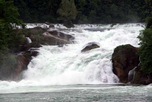 |
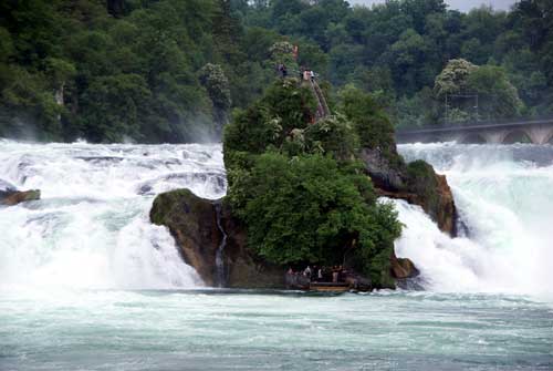 |
The depth of the pool is 13 metres (42 feet).
The size of the (damp!) tourists on the central viewing platform gives some idea of scale. |
| The falls are between 14,000 and 17,000 years old. |  |
 |
The average flow in summer is 600 m3 (21,180 ft3) per second. |
| The average flow in winter is 250 m3 (8,825 ft3) per second. | 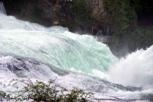 |
 |
The lowest ever flow was in 1921, when it was 95 m3
(3,354 ft3) per second.
The heron is totally unimpressed by all this, it's just another fishing hole to him. |
| The highest ever flow was in 1965, when it was 1,250 m3 (44,125 ft3) per second. |  |
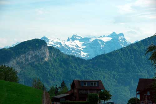 |
Moving on South, we get our first sight of Switzerland. |
| The scenery gets even more impressive as we travel South. |  |
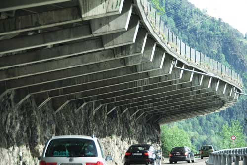 |
A typical road tunnel exit, with graduated snow protection barriers. |
| One of many churches along our way. |  |
 |
We arrived in Lucerne amid cloudy skies, but the amazing Kapellbrücke (Chapel Bridge) takes your mind off the weather! |
| The covered bridge crosses the Reuss River near the junction of
the river and the Vierwaldstättersee (Lake Lucerne).
The bridge bends as it leaves the shore, then angles across the river past an octagonal stone Wasserturm (Water-tower) that is believed to have once served as the "lucerna" (lighthouse), after which the town was named. |
 |
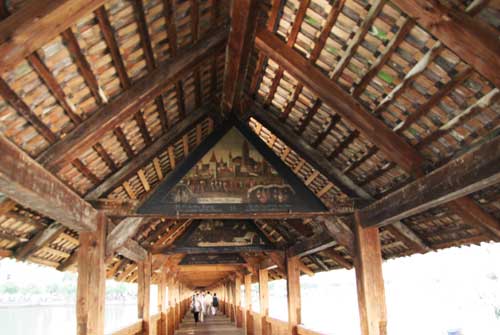 |
The bridge was built in 1333. As you cross its 200-meter (650
feet) length, you see 120 triangular paintings, from the early
1500s, that picture the city's history.
The paintings feature St. Mauritius and St. Leodegar, the patron saints of Lucerne. |
| In fact, the bridge is not as old as it looks. It was nearly destroyed by a 1993 fire, of which there is still some evidence (charred beams), hence much of what you see today is excellent restoration. | 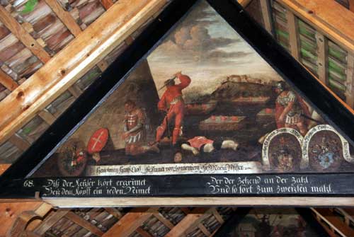 |
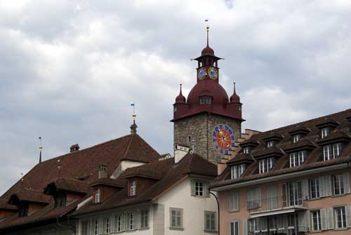 |
There is a great variety of architectural styles in Lucerne, perhaps one of the reasons it has become a very popular tourist resort. |
| The river teems with bird life, swans are the dominant species within the town stretch of water. |  |
 |
Not everything is peace and tranquility, as these noisy and aggressive moorhen show! |
| This is a view of Brienz Lake, one of the two that meet at Interlaken, taken as we were heading into the mountains. |  |
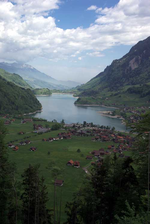 |
A more distant view of Lake Brienz - no less impressive, though. |
| Our first glimpse of the Jungfrau. | 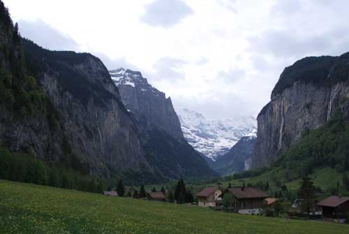 |
 |
The mountain is 4,158 metres (13,642 feet) high and was first climbed in 1811 by two Swiss brothers, Rudolf and Hieronymus Meyer. |
| Nowadays, thankfully, the ascent is made much easier by the cog railway, although it's the most expensive one in Europe! | 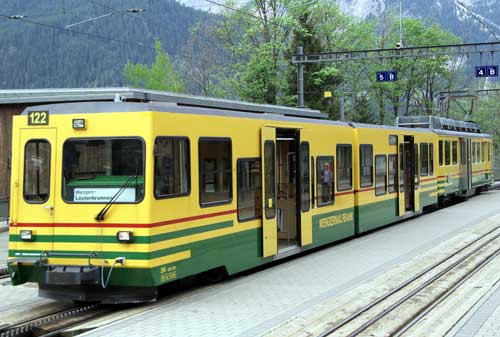 |
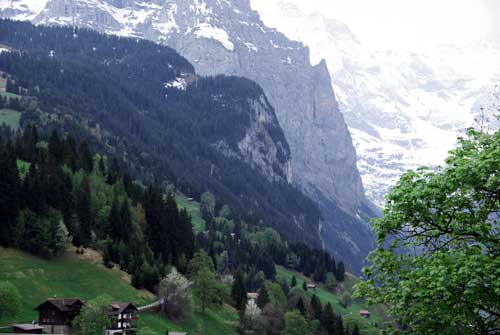 |
The journey is in two stages and the views going up are
stunning.
It's very difficult to capture in a picture, but I've had several attempts! |
| The ascent takes a route through the pastures of Wengen, passing many small clusters of buildings and food stores/shelters for livestock. | 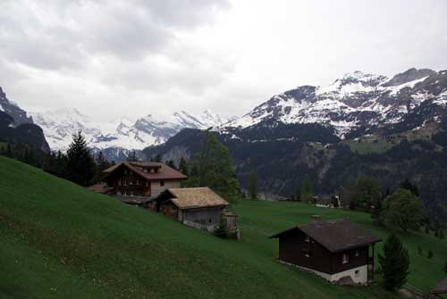 |
 |
A surprisingly large number of villages cling onto the moutainside, which are snow-covered for many months. |
| A view of the summit during the ascent. | 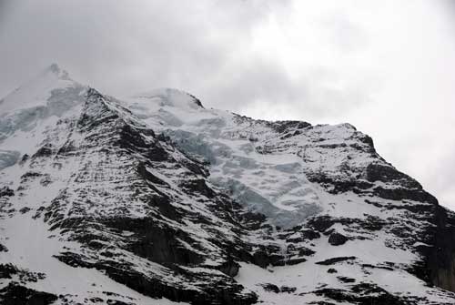 |
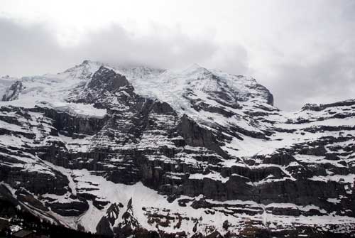 |
Although not totally covered in snow at this time of the year, for me that highlighted the size and structure more. |
| Although we were at quite an altitude, it was warm enough for us to shed our coats and walk about in comfort. | 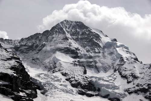 |
 |
In this shot you can just see the red cog train descending from
within the mountain. The railway goes through a tunnel for the
second part of the journey to the summit.
Work began on the tunnel on July 27, 1896 and was hit by many disasters, including the accidental explosion of 30 tons of dynamite in 1908. The blast was allegedly heard in Germany, more than 60 miles away. The main tunnel is 7.6 metres x 3.1 metres x 3.1 metres (4¾ miles long, 10 feet high and 10 feet wide). The construction was completed in 1912. |
| Here is the stop at Kleine Scheidegg - as far as we went. | 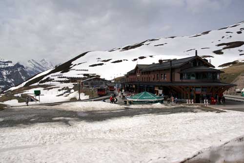 |
 |
The weather can change very quickly, as can be seen here. |
| This is the way to get about! | 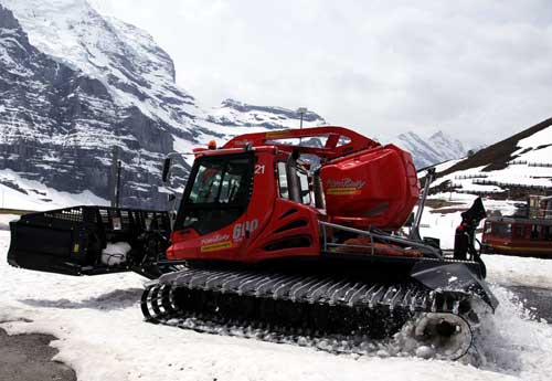 |
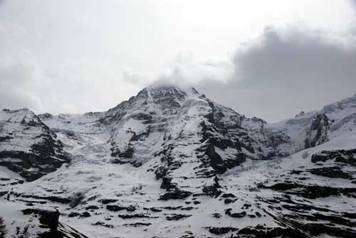 |
In this shot, the observation platform (known as "The Sphinx") can just be seen as a small hump to the right of the skyline. |
| Here's a closer view of The Sphinx, reached after an elevator ride of 111 metres (364 feet) from the railway station inside the mountain. It's known as the "Top of Europe." |  |
 |
On the descent, via the fields of Grindlewald, we passed a railway workers' hut - very ornate as well as practical. |
| This shot, hopefully, gives a rough idea of the angle of descent on the train. |  |
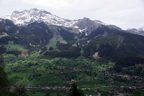 |
The Grindlewald (West) side of the mountain is much more populated. |
| It's hard to imagine skiers amongst these slopes, with all this grass on show. |  |
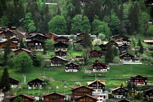 |
The villages all appear very neat and well maintained. |
| One of the older carriage sets at Grindlewald. | 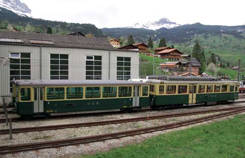 |
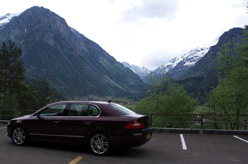 |
We're bidding the mountains "Goodbye!" here.
The car performed really well, exceeding my expectations. |
| Here's a shot of the car's SatNav, showing a typical route through the foothills. |  |
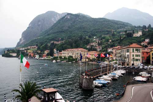 |
This was the view from our hotel room at Menaggio, on the Western shore of Lake Como, in Northern Italy. |
| The weather closed in on us the following day, so we hopped on a
ferry and went visiting around the lake.
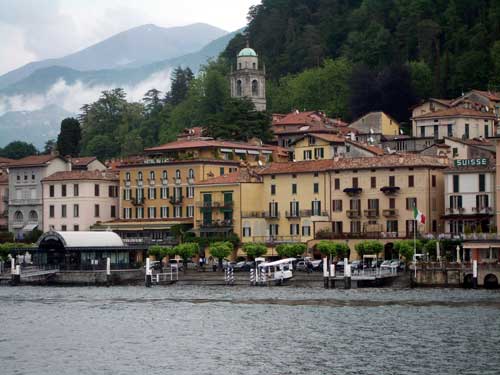
This is Bellagio, the inspiration for the "lakeside" buildings at the Las Vegas hotel of the same name. |
 |
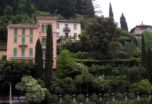 |
This is the little village of Varenna, where we had an excellent lunch. |
| One of the more "touristy" streets of Bellagio - still very attractive, though. |  |
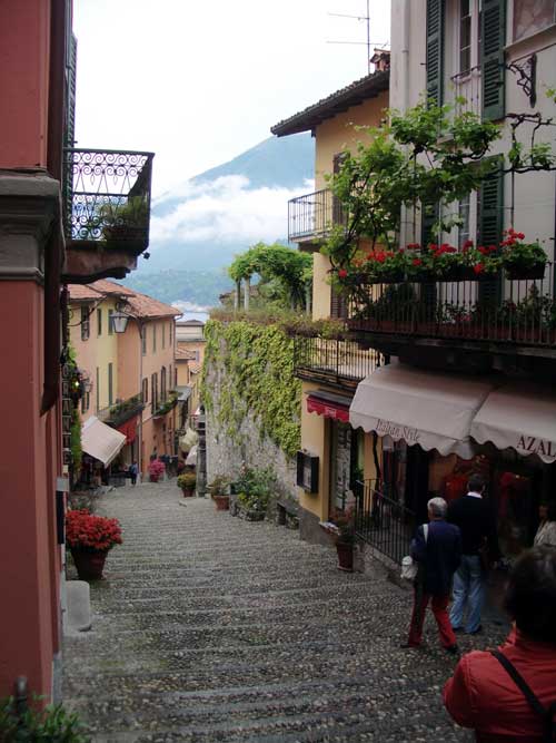 |
A better view from upper Bellagio, but the cloud is still increasing. |
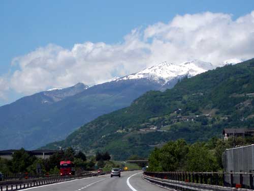
| This is Mont Blanc as we near the tunnel, which was built
between 1957 and 1965. It's 11.6 kilometres (7.25 miles) long, 8.6
metres (28.2 feet) wide, and 4.35 metres (14.3 feet) high.
When you enter it from the Italian side, it's so straight that it actually disappears into a central point of infinity, which is really strange. This feeling lasts for almost a mile, until the first slight bend appears. It costs 33 Euros to use the tunnel, one way! |
 |
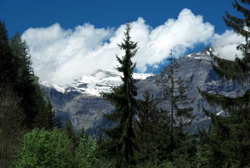 |
A closer view of Mont Blanc, which is 4260 meters (13976 feet) high. |
| The view from the French side. |  |
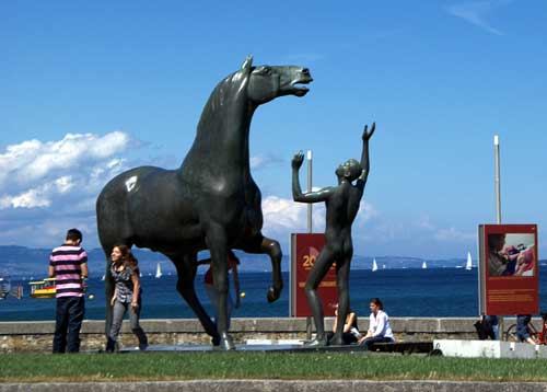 |
This is "L'Adolescent et le Cheval" by Swiss sculptor
Heinz Schwartz (1920 - 1994), on the Wilson Quay area of Lake
Geneva's shore.
It's actually a casting, rather than a sculpture, but very striking all the same. |
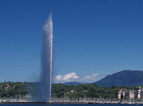
| Here's the famous "Jet d'eau" in Lake Geneva, one of
the largest fountains in the World. It shoots water 140 metres
(459 feet) into the air, propelled by two 500kW pumps, operating
at 2,400V.
The water leaves the nozzle at around 125 m.p.h. When pumping, at any given moment there are about 7,000 litres (1,849 gallons) of water in the air. Originally built in 1886 at the Usine de la Coulouvrenière, it was used as a safety valve for a hydro power generator. In 1891, it was moved to its present location to celebrate the Federal Gymnastics Festival and the 600th anniversary of the Swiss Confederation. The present Jet d'Eau was installed in 1951 in a partially-submerged pumping station to pump lake water (it previously used city water!). |
 |
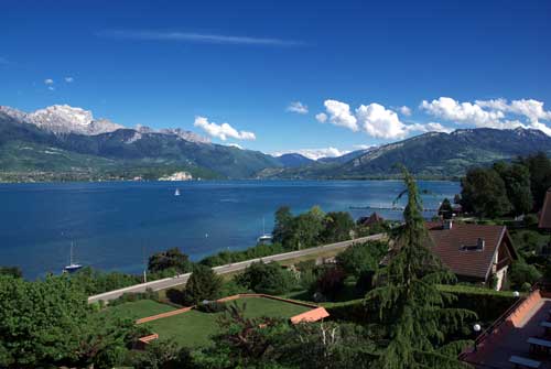 |
Our final outwards destination was Annecy, where we were
fortunate enough to have this view from our hotel balcony.
Our return journey began from here, taking us through (a largely-uninteresting) Eastern France. This uneventful journey completed the 2,127 miles we travelled, at an average of 48 miles to the (Imperial) gallon of diesel - a very satisfying result indeed for the size of our car. |